


Initial mindmap of the project. We want to create a methodology for one city and extend it to others.
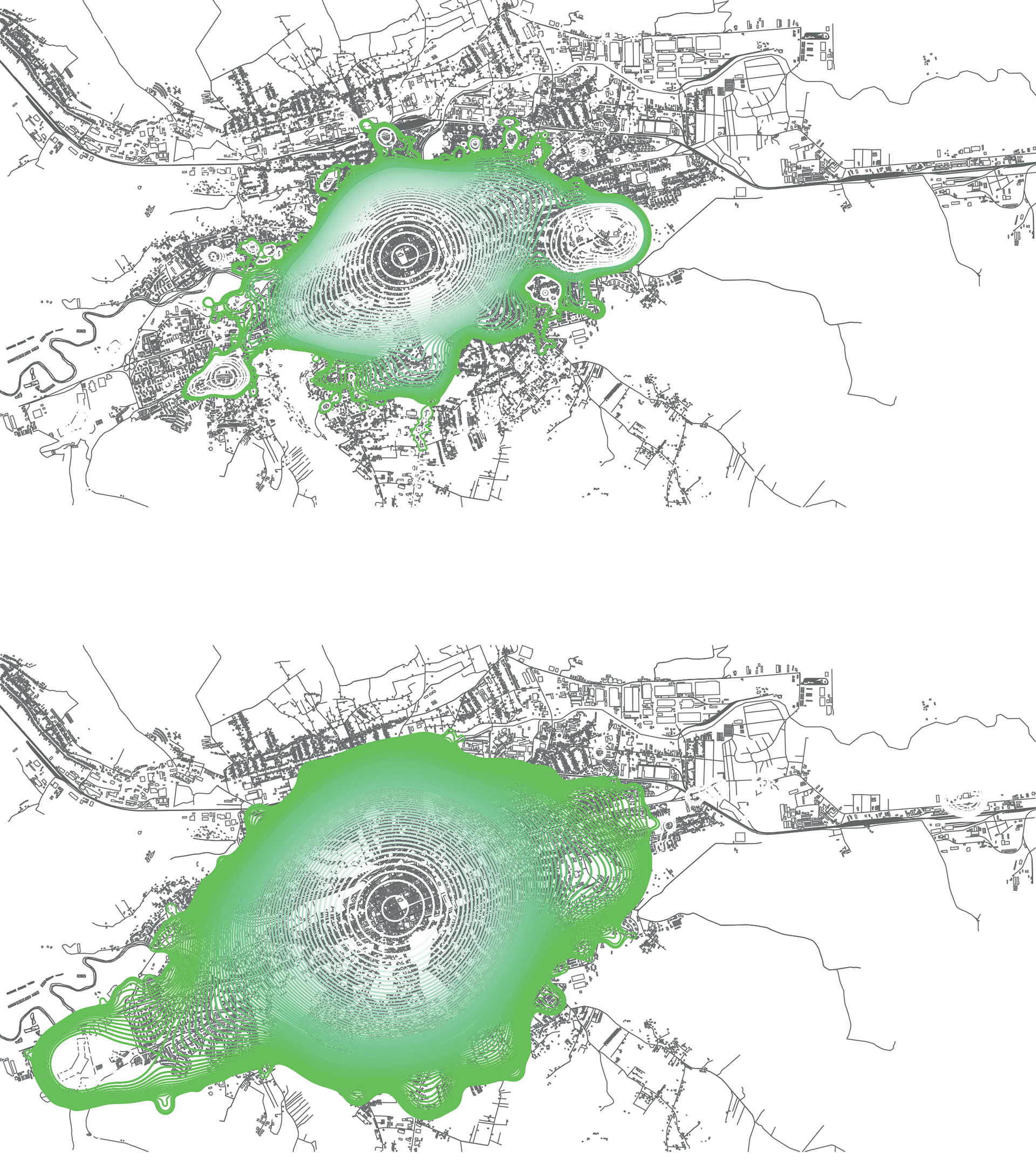
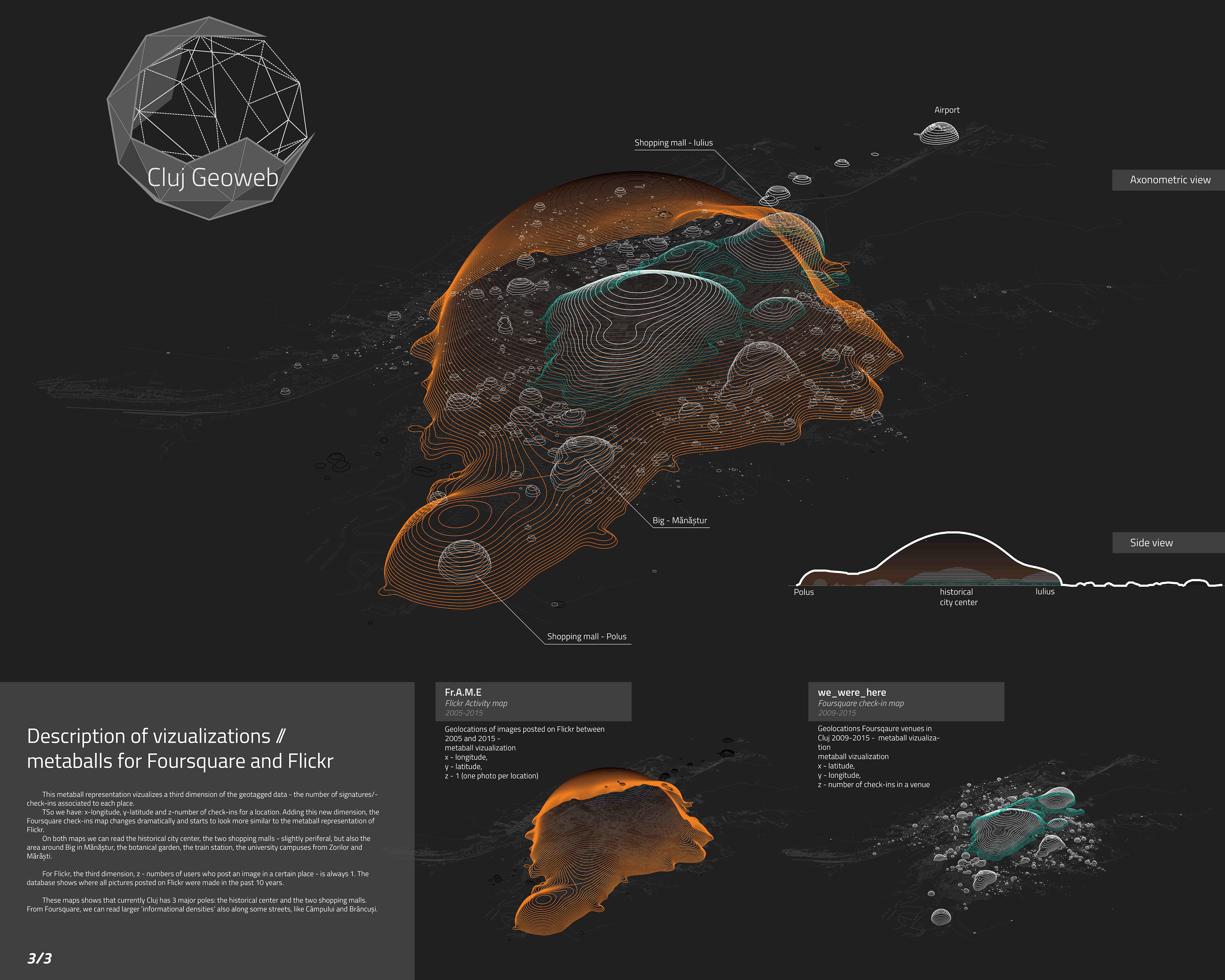
(up) Metaball representation of Foursquare check-ins registered between 2009 and 2015 in Cluj-Napoca, Romania.
[x - longitude, y - latitude, z - number of check-ins]
(down) Metaball representation of Flickr photo locations registered between 2005 and 2015 in Cluj-Napoca, Romania.
[x - longitude, y - latitude, z = 1]
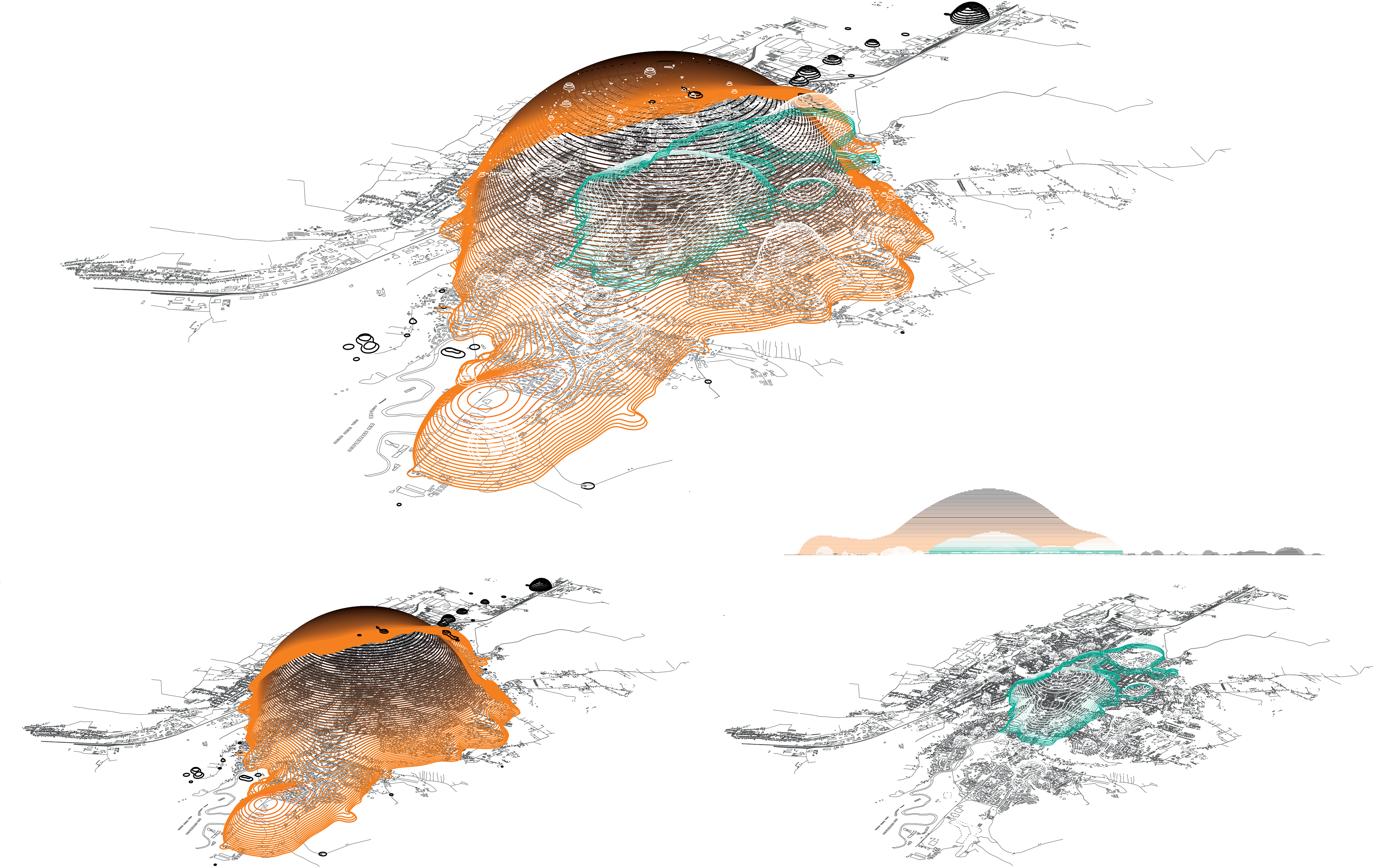
Spatial explorations of Cluj on 2 social media platforms: Foursquare (green) and Flickr (orange). The informational density shows 3 major poles - the city’s historical center and the 2 shopping malls.
Foursquare covers the city more evenly. Spikes in the metaball show neighbourhood centers, supermarkets,
the airport and the train station, and 'information' agglometations along some of the major streets in the city.